
|
|
|||
|
In-context Visualization for Land Development |
||
| Robert H. Ard | |||
| Session: April 17, 2000, 8:45 a.m.-11:30 a.m. | Author Info | ||
The world is blind. When it comes to visualizing how something will look before it's actually built, three-quarters of the general population just can't see it. Two-dimensional representations, model boards, and artist renderings have proven inadequate repeatedly. When people - citizenry, municipal planners, environmental advocates, historic preservationists, town business councils, elected municipal officials - believe they understand what a project, development, building, or whatever will look like by viewing these "proxies," most of the time their perceptions are wrong. Later they will feel duped, misled, misinformed. And it is the developer, his consulting engineers and architects who will bear the ramifications of their ire.
Out of a sincere desire to overcome the problem, some civil engineers, architects, and landscape architects have gone to great lengths to shoehorn 3D graphics technology into this visualization void. So far, it hasn't fit. It hasn't fit because a suitable solution has simply been out of reach in terms of cost. It's one thing to use advanced graphics technology to sink a ship in a movie or to train a fighter pilot to fly an F-15. It's another to take a virtual tour of a proposed new development in the context of an existing neighborhood.
Certainly low-end, lower-cost 3D graphics technology is exploding onto the scene. Thus far, however, it has been used mostly to explode people and buildings in computer video games. Even low-end CAD software that performs very well for its intended purpose has not transitioned well to project visualization. Re-purposing current technology to view the visual impact of new developments has been incredibly time consuming, difficult, and generally unsatisfying in achieving the desired effects.
What is the Need?
There is a strong desire and a compelling need shared by local government planners and elected officials, real estate developers, home builders, consulting engineers, architects, and landscape architects for photo-realistic, interactive 3D visualization for purposes of presentation and exploration in near-real time.
It is needed badly enough that the industry has laboriously worked to create photo montages in Photoshop, physical 3D models, and rudimentary 3D animations in lieu of an acceptable solution. Why? 3D visualization is an incomparable tool for winning approval quickly or speeding the funding process for a proposed project. It lets people "see" how they will be affected by future development, from a street-level view. It enables better qualitative judgements by policy makers and the public than 2D presentations can ever hope to yield. It provides both a big-picture view and close-in analysis in a photo-realistic context before the first spade of dirt is turned.
While no single application has been available to do the whole job, potential users already have many of the tools they need to accomplish 3D visualization. Most every professional in the land development food chain uses an engineering workstation, usually with AutoCAD software. Many large organizations and municipalities also have made the investment to develop large Geographic Information System (GIS) databases for analytical purposes. Exploiting CAD and GIS for information for 3D visualization is a natural next step.
The necessary "next step" requires a 3D visualization solution based upon technology that is modestly priced, easy to learn and use, and fast. Not only should we expect that such a solution would be widely accepted, but once established, 3D visualization will likely become mandatory in the approval process for any development project brought before municipal planners and regulatory bodies. Many locales already have such requirements in place, even though the technology to comply is incredibly inadequate, cumbersome, and resource consuming.
What are the Requirements?
Developing a product for this market was a natural extension of Evans & Sutherland's expertise, given that E&S invented the computer graphics industry in 1968 and remains the world leader in visual systems for simulation to this day. Extensive market research into the area of 3D visualization for planners, land developers, civil engineers, architects and landscape architects guided E&S in the creation of E&S RAPIDsiteTM, the first and only true visualization tool designed expressly for in-context visual impact analysis.
Our research revealed the following critical characteristics, which have defined RAPIDsite:
* It must run on a desktop computer.
* Speed and ease of use in generating models are of primary importance.
* Interactivity and photo realism are required, with the scene elements of greatest interest being the most photo realistic.
* It must be closely coupled with CAD and GIS.
* An effective solution must be priced below $10,000 with base configurations starting around $2,000.
RAPIDsite features fast model construction, fast graphics rendering performance, and interactive exploration of a project on a desktop computer at the right price. It enables the development of a photo-realistic 3D model of a development site, new and existing buildings, and new and existing landscape in a fraction of the time required by other visualization tools. Unlike many of these visualization tools, which leave their models hanging in space or ending abruptly at the edge of a grid pattern, a RAPIDsite model includes background imagery that extends to the horizon, placing the development in a realistic context. The viewer interactively tours the site in three dimensions by means of intuitive mouse control.
Evans & Sutherland has a long-standing business relationship with ESRI, the leading purveyor of GIS applications software in the world. RAPIDsite, which creates photo-realistic synthetic worlds, is a perfect complement to ESRI's ArcView GIS and 3D Analyst, which allow users to analyze and view spatial data of a site and the surrounding area in both 2D and 3D, but lack the interactive, photo-realistic walk-through and fly-through capabilities required for visual impact analysis. RAPIDsite uses ESRI grid and shape files as sources for terrain elevation and site plan data.
RAPIDsite is also compatible with AutoCAD from Autodesk, as well as other CAD systems that can write DWG files. RAPIDsite uses DWG drawings of site plans, terrain elevation contours, building footprints, and building elevations during the process of creating a photo-realistic 3D model of a proposed development.
RAPIDsite relies on digital photographic imagery as the source material for creating models of existing site elements such as buildings, vegetation, and a background panorama. Using a standard 35mm SLR camera with good quality color film or a digital camera with 1Mpixel resolution or greater, the RAPIDsite user simply visits the site and snaps the required photographs. If a 35mm camera is used, the film can be processed into a Kodak PictureCD. PictureCD processing, which is available nationwide from any local Kodak film processor, provides high-quality imagery at a pixel resolution ideal for use with RAPIDsite.
How RAPIDsite Works
RAPIDsite is designed to run on an Intel Pentium II or III processor with Windows NT 4.0 operating system. An OpenGL graphics accelerator card with 32MB of texture memory and a fill rate of at least 90 Megapixels per second is also needed. A list of qualified graphics cards may be found at www.es-rapidsite.com.
The software is available in two configurations - E&S RAPIDsite ExplorerTM and E&S RAPIDsite CreatorTM.
RAPIDsite Explorer is a near-real-time interactive viewer for walk-throughs of the development site. It also includes capabilities to import and position models of buildings, vegetation, vehicles, people, etc. RAPIDsite Creator includes all of the capabilities of Explorer plus the tools to build and organize the synthetic environment with realistic site topography and terrain texture, existing and planned buildings and structures, trees and vegetation, all of which is enveloped by a panoramic background image "dome."
RAPIDsite Explorer enables land development professionals and municipal planners to take interested parties on a 3D virtual tour of the proposed development site. The mouse-navigation interface is very intuitive and simple to use. RAPIDsite Explorer renders the scene at between 10-15 frames per second, providing true interactivity and the ability to instantly move anywhere and view the scene from any position. Flight paths through the database may also be captured and replayed so that a consistent presentation with identical content may be made. Scene imagery may be output in many formats including high-resolution still images and digital video.
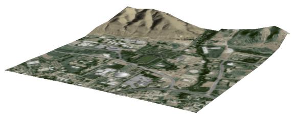
RAPIDsite Creator constructs a geometric model of the terrain from variety
of terrain elevation data sources. Terrain textures, constructed from a
variety of aerial image sources and from a library of photo textures of
natural, landscaped, and paved surfaces, are then applied to appropriate
surfaces of the site plan.
Next 3D models of existing buildings are built using desktop computer
photogrammetry; RAPIDsite tools enable the construction of a photo-realistic
3D model in just two to four hours instead two to four days as is typical
of the most popular alternative method.

New structures are built by importing CAD data into RAPIDsite, rapidly generating a 3D model, and adding photo-realistic textures to the elevation views.
New Building Model
Simple billboard-like models, or "cutout models", composed of only a
few polygons with photo-realistic texture and a transparency mask are constructed
from photographs in minutes. The transparency mask works like a cookie
cutter on a digital photograph, creating a photo-realistic model of an
object with a very complex silhouette - such as a tree - using a minimum
of polygons.
Using overlapping photographs taken of a 360-degree panorama, RAPIDsite creates a textured background dome around the development site.
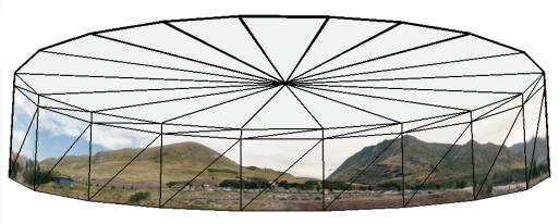
Panorama Model
Finally, all models of new and existing structures, as well as general vegetation and landmark trees, are interactively placed in their correct locations on the terrain model.
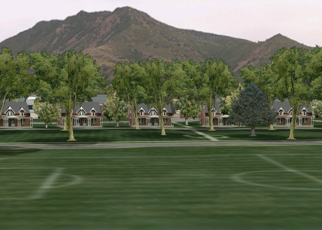
Screen Capture from Interactive E&S RAPIDsiteTM Visualization
Summary
Existing software products and tools are excellent solutions for problems they were designed to solve. However, there is a new and escalating need for creating 3D visualizations of land development projects, brought about by an increased scrutiny by government, community, and financial interests in such projects. No software product has been optimized to do this, until now.
| E&S RapidSiteTM | Other Approaches | |
| Model Output | Photo-realistic models | Architecturally accurate models |
| Visual Output | Interactive exploration. Static views and videos can be dynamically generated | Static views and pre-specified "flight" path videos |
| Time to produce 1 view | fraction of a second | minutes or hours |
| Time to produce 6 minute video | minutes | days |
| Time to create 1 building | hours | days |
| Environment assembly | proven technology | problematic |
| Terrain and vegetation | proven technology | problematic |
| Project duration | weeks | months |
Alternative Approach Comparison
It is now technically and economically feasible to construct photo-realistic
3D interactive visualizations of proposed development projects in urban,
suburban and environmentally sensitive areas. E&S RAPIDsiteTM
is a new product developed by Evans & Sutherland expressly for the
in-context visual impact analysis market. It is a complete system that
is easy to use and cost-effective for a large majority of projects.
Copyright 2000 By Author