
|
|
|||
|
New Urbanism, Old Cities, New Housing |
||
| Rudayna Abdo, AICP | |||
| Session: Sunday, April 16, 2000, 2:30 - 3:45 p.m. | Author Info | ||
This paper looks at recent housing trends in Minneapolis and compares neighborhood activity to the booming housing development of downtown.
Minneapolis, a city of 360,000, is the economic center of a region of
about 2.7 million. The region has enjoyed steady growth, particularly in
the newly developed suburbs. One in 3 houses in the 1970s was built in
Minneapolis, St. Paul or one of the fully developed suburbs. This number
dropped to one in five a decade later. Minneapolis saw an 18% drop in its
population from 1970 to 1994.
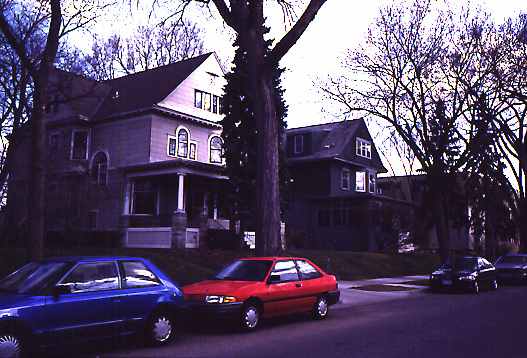 |
Minneapolis has had fully built neighborhoods for the past 50 years. The make-up of the neighborhoods is largely single family homes, with strong ownership tenure (figure 1). |
| Figure 1 | |
 |
Infill developments may be exemplified by Portland Place (figure 2) which has a typology of single family, attached houses, |
| Figure 2 | |
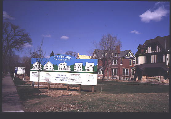 |
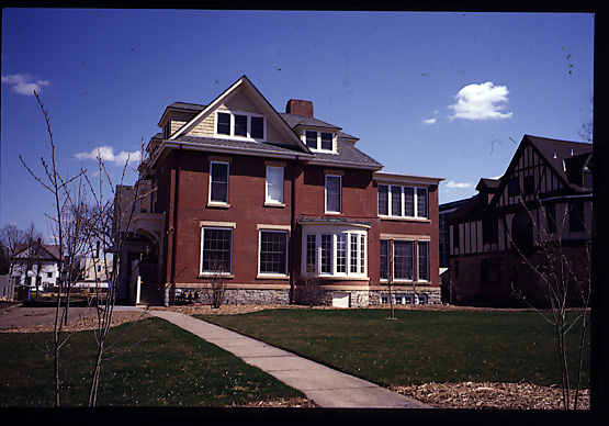
or the new houses on Park Avenue (figures 3, 4) which appear to be single family mansions but are, in fact, multi-unit developments. |
| Figure 3 | |
 |
|
| Figure 4 |
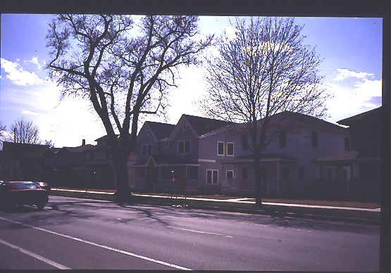
Minneapolis' population loss has largely been caused by shrinking household sizes (3.15 in 1970 vs. 2.67 in 1994 - national averages) as well as common central city problems such as a perception and fear of crime. There are, however, some well-intentioned policies that have hurt the stabilization of the inner city population.
These include the development of four new K-12 schools (figures 5, 6)
within a 15-square block area that led to the net loss of about 150 houses.
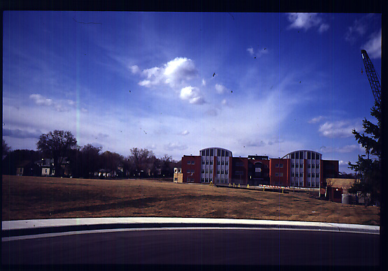 |
Figure 5 |
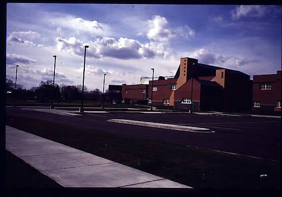 |
Figure 6 |
Another detrimental policy as far as population loss is concerned is the removal of 130 houses as a flood mitigation measure following serious flood damage in 1997.
Recently there has been a concerted effort amongst policy makers to "grow the city." This is often met with great resistance in the neighborhoods for the following reasons:
 |
One example is a recent high density, residential tower development (figure 7). This development, in one of the city's most desirable neighborhoods, was met with such resistance that it was only under the threat of a lawsuit that the developer succeeded in forging ahead. |
| Figure 7 |
Thus is the story of housing development in the city's established neighborhoods
where little progress, with few exceptions, has been made in bringing in
new people. Density has a bad name. In downtown, however, the picture becomes
much more optimistic.
 |
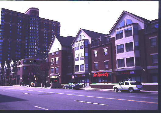
Since the 1980s, numerous towers have arisen close to the banks of the Mississippi (figure 8). While these developments have contributed to population growth, they have not embraced the river but rather sit heavily and solidly against it, shielding it from the urban core. |
| Figure 8 |
 |
 |
| Figure 9 | Figure 10 |
A new development of about 900 units in the early 1990s, Laurel Village,
started introducing a mix of housing styles from high-rise to hybrid that
include 4-story flats and townhomes (figures 9, 10).
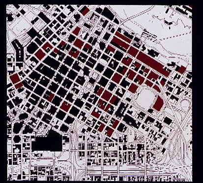
Figure 11
The map (figure 11) shows potential development sites in downtown where
the red sites are either vacant parcels or surface parking lots: there
are tremendous development opportunities.

Figure 12 |
There is also a tremendous opportunity to create new neighborhoods where non existed before, neighborhoods that will be of high density and that take advantage of all the amenities offered due to their proximity to the urban core, not least of which is the Mississippi River (figure 12). These neighborhoods are being created through the conversion of industrial land that had fallen into disuse. |
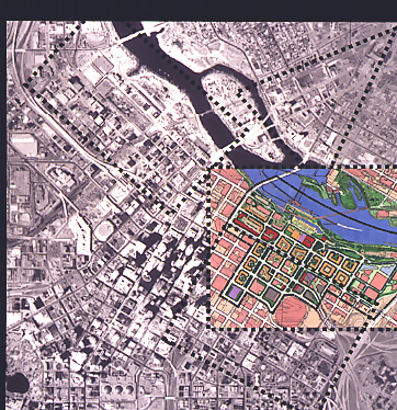
Figure 13 |
City policy makers seized this opportunity and proceeded with planning efforts in the mid 1990s to shape new development (figure 13 - dashed lines indicate areas of planning framework studies). |
| In the last three years, more than 1,200 units of development have been developed (or are under construction) along the riverfront, including the conversion of a milling building (figure 14) into loft condominiums. | 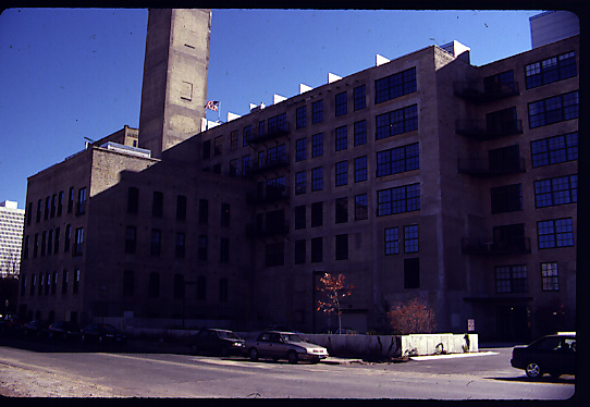
Figure 14 |
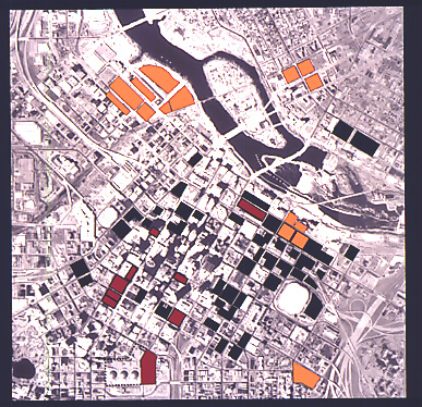
Figure 15 |
The map (figure 15) indicates new residential (yellow) and office (red) developments. The majority of residential development has been at the north-west sector of downtown, the North Loop. |
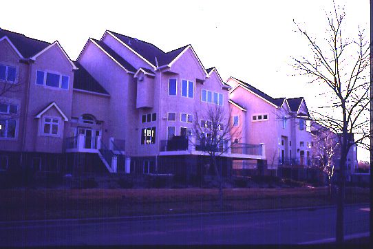
Figure 16 |
The first development that set the stage for subsequent developments (started in the early 1990s - figure 16) is of low density (5 dwelling units per acre - du/a). While it is suburban in character and does not relate to its context, its vast success quickly prodded other developers to partake in this development opportunity on the riverfront. |
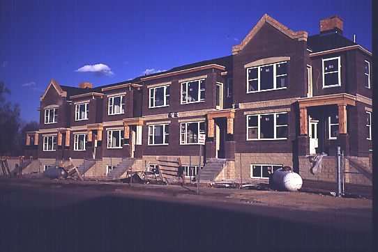
Figure 17 |
The development across the street (figure 17) is of higher density (17 du/a) and marks the first inner city development of this national home builder, Rottlund Homes. |
| Upon moving inland towards the warehouse district, new construction starts to take on more of a warehouse look with flat roofed, four-story buildings that have brick finishes. Densities here are much higher: 50 du/a for Riverstation (figure 21) and 80 du/a for Heritage Landing (figure 18, under construction). | 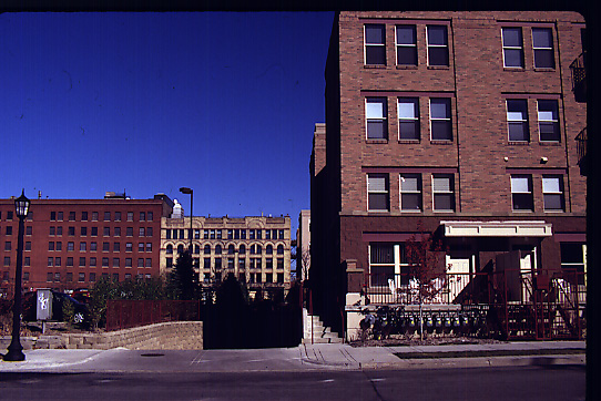
Figure 18 |
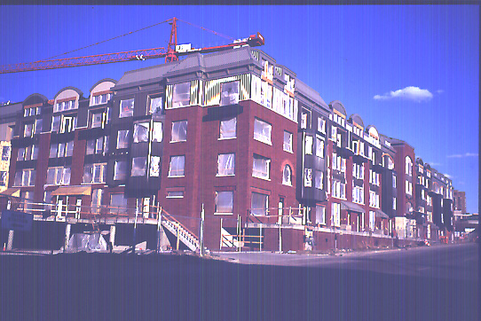
Figure 19 |
In addition to the mix of densities in this new neighborhood, there is also a mix in tenure (the townhomes and Heritage Landing are ownership units whereas Heritage Landing will be a rental property) and price-points (ranging from $165,000 to over $1million in the above-cited examples) as well as a provision of affordable units (figure 19). |
Moving further inland into the heart of the Historic Warehouse District
there are a few examples of conversions of warehouse buildings into residential
units (figure 20). The Warehouse District, however, poses great potential
for future residential conversions as remaining warehousing functions start
to move out of this location.
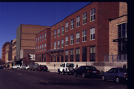 |
Figure 20 |
| It is not surprising to see the tremendous growth that has occurred around downtown Minneapolis in the last three years. The area has tremendous locational advantages: proximity to downtown (figure 21) and proximity of the amenities, such as entertainment and retail, provided by downtown. The demographics of the new residents, according to interviews with developers, are single people, married couples with no children, or empty nesters. Half of the residents have moved from elsewhere in Minneapolis and the other half have relocated from the suburbs or out of state. | 
Figure 21 |
While this microcosm is not balanced in that very few families with children have located here out of choice, there are some tremendous advantages:

Figure 22
Copyright 2000 By Author
Rudayna Abdo leads urban planning at Perkins and Will. Prior to joining P&W, Rudayna was a city planner with the Minneapolis Planning Department for 3 years. She can be reached at rudayna.abdo@perkinswill.com